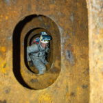
Classification society DNV GL and the German Aerospace Center (DLR) developed an indoor tracking solution for maritime inspections. The system does not rely on any infrastructure on the vessel. It automatically positions photos in a 3D hull condition monitoring model of a ship
A ship’s hull structure needs to be maintained in a condition sufficient to safeguard its structural integrity. To[ds_preview] make sure that this is the case – and to initiate repair in case it is not – periodic inspections are performed.
As an example, a typical ballast tank of a seagoing vessel is inspected once per year. This inspection is typically performed by the chief mate, or by a surveyor, if a survey is due. As crews change regularly and also most likely a different inspector will visit the vessel the next time, it is important that documentation of its condition is accessible and independent of person. Furthermore, it should be easy to compare the structural condition of a ship to the status during previous inspections.
Today digital photos play an important role in the documentation of the condition of a ship’s hull structure. They are frequently taken but are typically only managed like »photos in a shoe box« with no direct link to the hull structure. This makes it difficult and sometimes impossible to localize the structure shown on the photos for further follow-up or for monitoring activities if no positioning information was added. In case a 3D model of the ship is available, photos can be attached to the location inside the model. This functionality is available in different software systems, but the positioning of photos is still a manual process since automatic localization of photos, as is customary in today’s smartphones via GPS, cannot be applied due to the lack of GPS signals inside a ship compartment.
To overcome this problem, DNV GL and DLR developed an inspection system called IRIS. It allows compilation of inspection photos, their automatic spatial referencing and integration into a 3D model-based hull integrity management system without requiring GPS signals or any other pseudo satellite infrastructure installed on a vessel. The developed hands-free helmet-based inspection system IRIS is composed of two major components:
The mobile positioning system IPSpect was developed by DLR and is carried by the inspector. It consists of a helm-mounted sensor head, inspection camera, backpack, control pen and the navigation engine for position computation.
The 3D model-based hull integrity software ShipManager Hull managing the ship’s hull condition on board and on shore has been developed by DNV GL.
IPSpect allows automatic tracking of the helmet and orientation (position and attitude) of photos taken in rough enclosed environments such as tanks on board ships by only processing stereo camera images and inertial measurement signals collected by the sensor head. Referencing the IPSpect coordinate system to the ship coordinate system allows an automatic assignment of all photos to the 3D model inside ShipManager Hull.
Successful testing
The developed inspection system was tested on the museum ship »Cap San Diego« in the Port of Hamburg in a large cargo hold, an office-like shaft tunnel with good lighting and good accessibility and a dark, dirty and confined ballast water tank accessible only through a man hole.
For all three compartments IRIS was able to determine the helmet position and localize inspection photos taken during the test runs. Even in the ballast water tank with difficult illumination for the stereo cameras the system was capable of determining its position (positioning was checked by visualizing the helmet path in the 3D model). The photos taken by the inspector could be displayed in the 3D model documenting the current hull condition with a clear reference to the space.
In addition to the pure localization the system also creates depth maps of the photos allowing determination of 3D coordinates of a single pixel. Thus, positions of depicted details can be retrieved directly from the photo. Consequently also measuring of distances in inspection photos is possible or even computation of areas for repair planning purposes.
The developed IRIS system has proven to work in ship structures and has demonstrated how maritime inspection might be lifted up to a new level of information management. Documentation effort as well as errors can be significantly reduced. At the same time, training requirements for performing the inspection could decrease.
Christian Cabos


